water blips in the corners and the mesh points
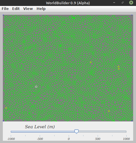
i can also toggle the mesh:
should this tool be showing something that looks like a map?
ran with args: -c /home/daddy/Documents/code/Java_Terrain/src/Templates/worldBuilder.json -d 3
logs:
`--- exec-maven-plugin:1.5.0:exec (default-cli) @ JavaTerrain ---
Configuration Parameters (/home/daddy/Documents/code/Java_Terrain/src/Templates/worldBuilder.json)
window: 1000x1000px, border=10px
waterways: stream=0.1m³/s, river=2.5m³/s, artery=25.0m³/s, deep=10.0m
erosion: Ve=0.40m/s, Vmax=3.0m/s, Ce=0.10, max susp=10.0%
sediment: Vmin=0.002m/s, Vd=0.01m/s, Cd=0.05
rainfall: default=50cm/y, Dp=0.5m, evapo-transpiration=4.00
mean temps: polar=-5.0°C, equator=30.0°C
max ranges: 1000km, altitude +/-5000m, msl +/-1000m
mountain diameter=world/2
initial slope=0.000010cm/km
sedimentary layer=100m
watershed=1000 m³/s
traderoutes:flat: 24 min/km, up: 250 min/km, cross 1m³/s: 60 min
travel 360 min/day, max 13.5 days between cities
resource placement:
flora rules: ecotopes.json
fauna rules: faunatopes.json
mineral rules: geotopes.json
export: name=Map001
rule file: Overworld.json
rule file: Outside.json
overlays: Overlay_objects.json
warnings: tiles=16384
icons: /icons
verbosity: 3
Display window <-0.5, -0.5> to <0.5, 0.5>
Resource rules (Default Floral Ecotopes) from ecotopes.json:
subtype: Taiga (1)
class: Tree
alt: 1500-2500
slope: 0.00-0.00
depth: 0.00-10.00
flux: 0.00-666.00
rain: 30.0-90.0
temp: -60.0-25.0
flora: NONE
range: strict
bid: tapered
color: 0,102,51
vigor: 32
order: 2
subtype: Temperate_Rainforest (2)
class: Tree
alt: 500-2000
slope: 0.00-0.00
depth: 0.00-10.00
flux: 0.00-666.00
rain: 75.0-120.0
temp: 0.0-30.0
flora: NONE
range: strict
bid: tapered
color: 128,255,0
vigor: 32
order: 2
subtype: Tropical_Rainforest (3)
class: Tree
alt: 0-1000
slope: 0.00-0.00
depth: 0.00-10.00
flux: 0.00-666.00
rain: 100.0-666.0
temp: 15.0-70.0
flora: NONE
range: strict
bid: tapered
color: 76,153,0
vigor: 32
order: 2
subtype: Tropical_Forest (4)
class: Tree
alt: 0-100
slope: 0.00-0.00
depth: 0.00-10.00
flux: 0.00-666.00
rain: 20.0-50.0
temp: 15.0-70.0
flora: NONE
range: strict
bid: tapered
color: 76,200,0
vigor: 32
order: 3
subtype: Riperian (5)
class: Brush
alt: 100-1500
slope: 0.00-0.00
depth: 0.00-10.00
flux: 0.30-9.90
rain: 60.0-120.0
temp: 0.0-28.0
flora: NONE
range: strict
bid: tapered
color: 178,102,255
vigor: 32
order: 1
subtype: Marsh (6)
class: Grass
alt: -5000-5000
slope: 0.00-0.00
depth: 0.00-10.00
flux: 0.00-666.00
rain: 0.0-666.0
temp: -60.0-70.0
flora: NONE
range: strict
bid: flat
color: 153,255,204
vigor: 0
order: 3
subtype: Shrubland (7)
class: Brush
alt: 0-1000
slope: 0.00-0.00
depth: 0.00-10.00
flux: 0.00-666.00
rain: 25.0-50.0
temp: -60.0-70.0
flora: NONE
range: flexible
bid: tapered
color: 0,153,153
vigor: 16
order: 4
subtype: Savanna (8)
class: Grass
alt: 100-1500
slope: 0.00-0.00
depth: 0.00-10.00
flux: 0.00-666.00
rain: 25.0-100.0
temp: 0.0-20.0
flora: NONE
range: flexible
bid: tapered
color: 178,255,102
vigor: 32
order: 5
subtype: Grassland (9)
class: Grass
alt: 100-1500
slope: 0.00-0.00
depth: 0.00-10.00
flux: 0.00-666.00
rain: 25.0-100.0
temp: 0.0-20.0
flora: NONE
range: flexible
bid: tapered
color: 178,255,102
vigor: 32
order: 5
subtype: Tundra (10)
class: Barren
alt: 2500-5000
slope: 0.00-0.00
depth: 0.00-10.00
flux: 0.00-666.00
rain: 0.0-666.0
temp: -60.0-15.0
flora: NONE
range: strict
bid: tapered
color: 192,192,192
vigor: 32
order: 9
subtype: Desert (11)
class: Barren
alt: -5000-5000
slope: 0.00-0.00
depth: 0.00-10.00
flux: 0.00-666.00
rain: 0.0-25.0
temp: 15.0-70.0
flora: NONE
range: strict
bid: flat
color: 255,204,153
vigor: 32
order: 9
Resource rules (Default Fauna) from faunatopes.json:
subtype: Fish (1)
class: Fish
alt: -5000-5000
slope: 0.00-100.00
depth: 10.00-10.00
flux: 0.00-666.00
rain: 0.0-666.0
temp: -60.0-70.0
flora: NONE
range: strict
bid: flat
color: 127,0,255
vigor: 32
order: 4
subtype: Birds (2)
class: Birds
alt: -5000-5000
slope: 0.00-0.00
depth: 0.00-10.00
flux: 0.00-666.00
rain: 0.0-666.0
temp: -60.0-70.0
flora: NONE
range: strict
bid: flat
color: 255,204,153
vigor: 32
order: 3
subtype: Rabbits (3)
class: Small Game
alt: -5000-5000
slope: 0.00-0.00
depth: 0.00-10.00
flux: 0.00-666.00
rain: 0.0-666.0
temp: -60.0-70.0
flora: Grassland
range: strict
bid: flat
color: 204,204,0
vigor: 32
order: 2
subtype: Foxes (4)
class: Small Game
alt: -5000-5000
slope: 0.00-0.00
depth: 0.00-10.00
flux: 0.00-666.00
rain: 0.0-666.0
temp: -60.0-70.0
flora: Temperate_Rainforest
range: strict
bid: flat
color: 255,102,102
vigor: 32
order: 2
subtype: Deer (5)
class: Large Game
alt: -5000-5000
slope: 0.00-0.00
depth: 0.00-10.00
flux: 0.00-666.00
rain: 0.0-666.0
temp: -60.0-70.0
flora: Temperate_Rainforest
range: strict
bid: flat
color: 255,153,51
vigor: 32
order: 1
subtype: Bear (6)
class: Large Game
alt: -5000-5000
slope: 0.00-0.00
depth: 0.00-10.00
flux: 0.00-666.00
rain: 0.0-666.0
temp: -60.0-70.0
flora: Taiga
range: strict
bid: flat
color: 153,76,0
vigor: 32
order: 1
Resource rules (Default Minerals) from geotopes.json:
subtype: Alluvial (1)
alt: -5000-5000
slope: 0.00-0.00
depth: 0.00-10.00
flux: 0.00-666.00
rain: 0.0-666.0
temp: -60.0-70.0
flora: NONE
range: strict
bid: flat
color: 143,76,0
vigor: 16
order: 9
subtype: Sand Stone (2)
class: Stone
alt: 300-600
slope: 0.00-0.00
depth: 0.00-10.00
flux: 0.00-666.00
rain: 0.0-666.0
temp: -60.0-70.0
flora: NONE
range: strict
bid: flat
color: 255,204,153
vigor: 32
order: 9
subtype: Granite (3)
class: Stone
alt: 1000-2000
slope: 0.00-0.00
depth: 0.00-10.00
flux: 0.00-666.00
rain: 0.0-666.0
temp: -60.0-70.0
flora: NONE
range: strict
bid: flat
color: 224,224,224
vigor: 32
order: 9
subtype: Basalt (4)
class: Stone
alt: -5000-5000
slope: 0.00-0.00
depth: 0.00-10.00
flux: 0.00-666.00
rain: 0.0-666.0
temp: -60.0-70.0
flora: NONE
range: strict
bid: flat
color: 128,128,128
vigor: 16
order: 9
subtype: Lime Stone (5)
class: Stone
alt: 0-100
slope: 0.00-0.00
depth: 0.00-10.00
flux: 0.00-666.00
rain: 0.0-666.0
temp: -60.0-70.0
flora: NONE
range: strict
bid: flat
color: 229,255,204
vigor: 32
order: 9
subtype: Marble (6)
class: Stone
alt: -5000-5000
slope: 0.00-0.00
depth: 0.00-10.00
flux: 0.00-666.00
rain: 0.0-666.0
temp: -60.0-70.0
flora: NONE
range: strict
bid: flat
color: 255,209,204
vigor: 16
order: 9
subtype: Copper Ore (7)
class: Metal
alt: -5000-5000
slope: 0.00-0.00
depth: 0.00-10.00
flux: 0.00-666.00
rain: 0.0-666.0
temp: -60.0-70.0
flora: NONE
range: strict
bid: flat
color: 153,153,0
vigor: 16
order: 9
subtype: Iron Ore (8)
class: Metal
alt: 100-350
slope: 0.00-0.00
depth: 0.00-10.00
flux: 0.00-666.00
rain: 0.0-666.0
temp: -60.0-70.0
flora: NONE
range: strict
bid: tapered
color: 153,0,0
vigor: 32
order: 9
subtype: Silver (9)
class: Precious
alt: -5000-5000
slope: 0.00-0.00
depth: 0.00-10.00
flux: 0.00-666.00
rain: 0.0-666.0
temp: -60.0-70.0
flora: NONE
range: strict
bid: flat
color: 192,192,192
vigor: 16
order: 9
subtype: Gold (10)
class: Precious
alt: 1000-2000
slope: 0.00-0.00
depth: 0.00-10.00
flux: 5.00-666.00
rain: 0.0-666.0
temp: -60.0-70.0
flora: NONE
range: strict
bid: flat
color: 255,215,0
vigor: 64
order: 9
Loaded 7978/7978 points, 11861 paths from file ./Templates/default_4096.json
Drainage tracing enabled to /tmp/drainage_debug.log
Drainage: land/sea = 7978/0
DownHill audit: 7978 land points, refcount=7769, pointers=7769
WaterFlow tracing enabled to /tmp/erosion_debug.log
WaterFlow: world=200x200km²/7978 points, 100cm/y rain -> 0.1589m³/s (per point)
Drainage tracing enabled to /tmp/drainage_debug.log
Drainage: land/sea = 7978/0
DownHill audit: 7978 land points, refcount=7849, pointers=7849
WaterFlow tracing enabled to /tmp/erosion_debug.log
WaterFlow: world=200x200km²/7978 points, 100cm/y rain -> 0.1589m³/s (per point)
World Configuration
mapped area: 200x200km², max altitude 2500m
planetary: lat=30.00000°, lon=-90.00000°, radius=6371km, tilt=23.5°
Tmean=21.0°C, Tsummer=24.8°C, Twinter=12.8°C
topo maps: 100m/line, 10 minors/major
region: Never-Never-Land (where dreams come true), author=daddy
Geographic Ranges
altitude: 0.0-0m (MSL)
slope: 0.000-0.000
rivers: NONE
erosion: NONE, deposition: NONE
verbosity: 0
Write error to log file /tmp/drainage_debug.log`
water blips in the corners and the mesh points

i can also toggle the mesh:

should this tool be showing something that looks like a map?
ran with args:
-c /home/daddy/Documents/code/Java_Terrain/src/Templates/worldBuilder.json -d 3logs:
`--- exec-maven-plugin:1.5.0:exec (default-cli) @ JavaTerrain ---
Configuration Parameters (/home/daddy/Documents/code/Java_Terrain/src/Templates/worldBuilder.json)
window: 1000x1000px, border=10px
waterways: stream=0.1m³/s, river=2.5m³/s, artery=25.0m³/s, deep=10.0m
erosion: Ve=0.40m/s, Vmax=3.0m/s, Ce=0.10, max susp=10.0%
sediment: Vmin=0.002m/s, Vd=0.01m/s, Cd=0.05
rainfall: default=50cm/y, Dp=0.5m, evapo-transpiration=4.00
mean temps: polar=-5.0°C, equator=30.0°C
max ranges: 1000km, altitude +/-5000m, msl +/-1000m
mountain diameter=world/2
initial slope=0.000010cm/km
sedimentary layer=100m
watershed=1000 m³/s
traderoutes:flat: 24 min/km, up: 250 min/km, cross 1m³/s: 60 min
travel 360 min/day, max 13.5 days between cities
resource placement:
flora rules: ecotopes.json
fauna rules: faunatopes.json
mineral rules: geotopes.json
export: name=Map001
rule file: Overworld.json
rule file: Outside.json
overlays: Overlay_objects.json
warnings: tiles=16384
icons: /icons
verbosity: 3
Display window <-0.5, -0.5> to <0.5, 0.5>
Resource rules (Default Floral Ecotopes) from ecotopes.json:
subtype: Taiga (1)
class: Tree
alt: 1500-2500
slope: 0.00-0.00
depth: 0.00-10.00
flux: 0.00-666.00
rain: 30.0-90.0
temp: -60.0-25.0
flora: NONE
range: strict
bid: tapered
color: 0,102,51
vigor: 32
order: 2
subtype: Temperate_Rainforest (2)
class: Tree
alt: 500-2000
slope: 0.00-0.00
depth: 0.00-10.00
flux: 0.00-666.00
rain: 75.0-120.0
temp: 0.0-30.0
flora: NONE
range: strict
bid: tapered
color: 128,255,0
vigor: 32
order: 2
subtype: Tropical_Rainforest (3)
class: Tree
alt: 0-1000
slope: 0.00-0.00
depth: 0.00-10.00
flux: 0.00-666.00
rain: 100.0-666.0
temp: 15.0-70.0
flora: NONE
range: strict
bid: tapered
color: 76,153,0
vigor: 32
order: 2
subtype: Tropical_Forest (4)
class: Tree
alt: 0-100
slope: 0.00-0.00
depth: 0.00-10.00
flux: 0.00-666.00
rain: 20.0-50.0
temp: 15.0-70.0
flora: NONE
range: strict
bid: tapered
color: 76,200,0
vigor: 32
order: 3
subtype: Riperian (5)
class: Brush
alt: 100-1500
slope: 0.00-0.00
depth: 0.00-10.00
flux: 0.30-9.90
rain: 60.0-120.0
temp: 0.0-28.0
flora: NONE
range: strict
bid: tapered
color: 178,102,255
vigor: 32
order: 1
subtype: Marsh (6)
class: Grass
alt: -5000-5000
slope: 0.00-0.00
depth: 0.00-10.00
flux: 0.00-666.00
rain: 0.0-666.0
temp: -60.0-70.0
flora: NONE
range: strict
bid: flat
color: 153,255,204
vigor: 0
order: 3
subtype: Shrubland (7)
class: Brush
alt: 0-1000
slope: 0.00-0.00
depth: 0.00-10.00
flux: 0.00-666.00
rain: 25.0-50.0
temp: -60.0-70.0
flora: NONE
range: flexible
bid: tapered
color: 0,153,153
vigor: 16
order: 4
subtype: Savanna (8)
class: Grass
alt: 100-1500
slope: 0.00-0.00
depth: 0.00-10.00
flux: 0.00-666.00
rain: 25.0-100.0
temp: 0.0-20.0
flora: NONE
range: flexible
bid: tapered
color: 178,255,102
vigor: 32
order: 5
subtype: Grassland (9)
class: Grass
alt: 100-1500
slope: 0.00-0.00
depth: 0.00-10.00
flux: 0.00-666.00
rain: 25.0-100.0
temp: 0.0-20.0
flora: NONE
range: flexible
bid: tapered
color: 178,255,102
vigor: 32
order: 5
subtype: Tundra (10)
class: Barren
alt: 2500-5000
slope: 0.00-0.00
depth: 0.00-10.00
flux: 0.00-666.00
rain: 0.0-666.0
temp: -60.0-15.0
flora: NONE
range: strict
bid: tapered
color: 192,192,192
vigor: 32
order: 9
subtype: Desert (11)
class: Barren
alt: -5000-5000
slope: 0.00-0.00
depth: 0.00-10.00
flux: 0.00-666.00
rain: 0.0-25.0
temp: 15.0-70.0
flora: NONE
range: strict
bid: flat
color: 255,204,153
vigor: 32
order: 9
Resource rules (Default Fauna) from faunatopes.json:
subtype: Fish (1)
class: Fish
alt: -5000-5000
slope: 0.00-100.00
depth: 10.00-10.00
flux: 0.00-666.00
rain: 0.0-666.0
temp: -60.0-70.0
flora: NONE
range: strict
bid: flat
color: 127,0,255
vigor: 32
order: 4
subtype: Birds (2)
class: Birds
alt: -5000-5000
slope: 0.00-0.00
depth: 0.00-10.00
flux: 0.00-666.00
rain: 0.0-666.0
temp: -60.0-70.0
flora: NONE
range: strict
bid: flat
color: 255,204,153
vigor: 32
order: 3
subtype: Rabbits (3)
class: Small Game
alt: -5000-5000
slope: 0.00-0.00
depth: 0.00-10.00
flux: 0.00-666.00
rain: 0.0-666.0
temp: -60.0-70.0
flora: Grassland
range: strict
bid: flat
color: 204,204,0
vigor: 32
order: 2
subtype: Foxes (4)
class: Small Game
alt: -5000-5000
slope: 0.00-0.00
depth: 0.00-10.00
flux: 0.00-666.00
rain: 0.0-666.0
temp: -60.0-70.0
flora: Temperate_Rainforest
range: strict
bid: flat
color: 255,102,102
vigor: 32
order: 2
subtype: Deer (5)
class: Large Game
alt: -5000-5000
slope: 0.00-0.00
depth: 0.00-10.00
flux: 0.00-666.00
rain: 0.0-666.0
temp: -60.0-70.0
flora: Temperate_Rainforest
range: strict
bid: flat
color: 255,153,51
vigor: 32
order: 1
subtype: Bear (6)
class: Large Game
alt: -5000-5000
slope: 0.00-0.00
depth: 0.00-10.00
flux: 0.00-666.00
rain: 0.0-666.0
temp: -60.0-70.0
flora: Taiga
range: strict
bid: flat
color: 153,76,0
vigor: 32
order: 1
Resource rules (Default Minerals) from geotopes.json:
subtype: Alluvial (1)
alt: -5000-5000
slope: 0.00-0.00
depth: 0.00-10.00
flux: 0.00-666.00
rain: 0.0-666.0
temp: -60.0-70.0
flora: NONE
range: strict
bid: flat
color: 143,76,0
vigor: 16
order: 9
subtype: Sand Stone (2)
class: Stone
alt: 300-600
slope: 0.00-0.00
depth: 0.00-10.00
flux: 0.00-666.00
rain: 0.0-666.0
temp: -60.0-70.0
flora: NONE
range: strict
bid: flat
color: 255,204,153
vigor: 32
order: 9
subtype: Granite (3)
class: Stone
alt: 1000-2000
slope: 0.00-0.00
depth: 0.00-10.00
flux: 0.00-666.00
rain: 0.0-666.0
temp: -60.0-70.0
flora: NONE
range: strict
bid: flat
color: 224,224,224
vigor: 32
order: 9
subtype: Basalt (4)
class: Stone
alt: -5000-5000
slope: 0.00-0.00
depth: 0.00-10.00
flux: 0.00-666.00
rain: 0.0-666.0
temp: -60.0-70.0
flora: NONE
range: strict
bid: flat
color: 128,128,128
vigor: 16
order: 9
subtype: Lime Stone (5)
class: Stone
alt: 0-100
slope: 0.00-0.00
depth: 0.00-10.00
flux: 0.00-666.00
rain: 0.0-666.0
temp: -60.0-70.0
flora: NONE
range: strict
bid: flat
color: 229,255,204
vigor: 32
order: 9
subtype: Marble (6)
class: Stone
alt: -5000-5000
slope: 0.00-0.00
depth: 0.00-10.00
flux: 0.00-666.00
rain: 0.0-666.0
temp: -60.0-70.0
flora: NONE
range: strict
bid: flat
color: 255,209,204
vigor: 16
order: 9
subtype: Copper Ore (7)
class: Metal
alt: -5000-5000
slope: 0.00-0.00
depth: 0.00-10.00
flux: 0.00-666.00
rain: 0.0-666.0
temp: -60.0-70.0
flora: NONE
range: strict
bid: flat
color: 153,153,0
vigor: 16
order: 9
subtype: Iron Ore (8)
class: Metal
alt: 100-350
slope: 0.00-0.00
depth: 0.00-10.00
flux: 0.00-666.00
rain: 0.0-666.0
temp: -60.0-70.0
flora: NONE
range: strict
bid: tapered
color: 153,0,0
vigor: 32
order: 9
subtype: Silver (9)
class: Precious
alt: -5000-5000
slope: 0.00-0.00
depth: 0.00-10.00
flux: 0.00-666.00
rain: 0.0-666.0
temp: -60.0-70.0
flora: NONE
range: strict
bid: flat
color: 192,192,192
vigor: 16
order: 9
subtype: Gold (10)
class: Precious
alt: 1000-2000
slope: 0.00-0.00
depth: 0.00-10.00
flux: 5.00-666.00
rain: 0.0-666.0
temp: -60.0-70.0
flora: NONE
range: strict
bid: flat
color: 255,215,0
vigor: 64
order: 9
Loaded 7978/7978 points, 11861 paths from file ./Templates/default_4096.json
Drainage tracing enabled to /tmp/drainage_debug.log
Drainage: land/sea = 7978/0
DownHill audit: 7978 land points, refcount=7769, pointers=7769
WaterFlow tracing enabled to /tmp/erosion_debug.log
WaterFlow: world=200x200km²/7978 points, 100cm/y rain -> 0.1589m³/s (per point)
Drainage tracing enabled to /tmp/drainage_debug.log
Drainage: land/sea = 7978/0
DownHill audit: 7978 land points, refcount=7849, pointers=7849
WaterFlow tracing enabled to /tmp/erosion_debug.log
WaterFlow: world=200x200km²/7978 points, 100cm/y rain -> 0.1589m³/s (per point)
World Configuration
mapped area: 200x200km², max altitude 2500m
planetary: lat=30.00000°, lon=-90.00000°, radius=6371km, tilt=23.5°
Tmean=21.0°C, Tsummer=24.8°C, Twinter=12.8°C
topo maps: 100m/line, 10 minors/major
region: Never-Never-Land (where dreams come true), author=daddy
Geographic Ranges
altitude: 0.0-0m (MSL)
slope: 0.000-0.000
rivers: NONE
erosion: NONE, deposition: NONE
verbosity: 0
Write error to log file /tmp/drainage_debug.log`